|
| You might also like: | Outline Map Texas | Karakul Sheep Printout | Texas State Map Definitions | Whippet Printout | Loris Printout | Today's featured page: USA Regional Map/Quiz Printouts |
| Our subscribers' grade-level estimate for this page: 3rd |
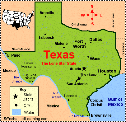
 Texas Map Quiz/Printout Texas Map Label Me! Printout Texas Outline Map Printout |
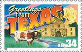
EnchantedLearning.com Texas Facts, Map and State Symbols |
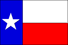
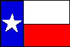 Texas Flag Printout/Quiz Large Flag Printable |
 State Abbreviation - TX
State Capital - Austin
Largest City - Houston
Area - 268,601 square miles [Texas is the second biggest state in the USA - only Alaska is bigger]
Population - 26,448,193
(as of 2013) [Texas is the second most populous state in the USA, after California; New York is the third most populous]
Name for Residents - Texans
Major Industries - petroleum and natural gas, farming (cotton, livestock), steel, banking, insurance, tourism
Presidential Birthplaces
Dwight David Eisenhower was born in Denison on October 14, 1890 (he was the 34th US President, serving from 1953 to 1961).
Lyndon Baines Johnson was born near Johnson City on August 27, 1908 (he was the 36th US President, serving from 1963 to 1969).
Main Rivers - Rio Grande, Red River, Brazos River
Highest Point - Guadalupe Peak, 8,749 feet (2,667 m) above sea level
Number of Counties - 254
Bordering States - Arkansas, Louisiana, New Mexico, Oklahoma
Bordering Country - Mexico
Bordering Body of Water - Gulf of Mexico
 Origin of the Name Texas - The Caddo Indians of eastern Texas called their group of tribes the "Tejas," meaning "those who are friends".
State Nickname - The Lone Star State
State Motto - Friendship
State Song - "Texas, Our Texas"
Dinosaur Fossils Found in Texas - Acrocanthosaurus, Alamosaurus, Brontopodus, Camptosaurus, Chasmosaurus, Coelophysis, Deinonychus, Dimetrodon*, Edmontosaurus, Hypsilophodon, Iguanodon, Kritosaurus, Megatherium* (giant ground sloth), Ornithomimus, Panoplosaurus, Pawpawsaurus, Pleurocoelus, Protohadros byrdi, Quetzalcoatlus*, Shuvosaurus, Stegoceras, Technosaurus, Tenontosaurus, Texascetes, Torosaurus, Tyrannosaurus rex
Texas State Symbols and Emblems:
| State Flag
|
Animal Symbols:
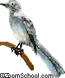
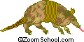
| State Bird | State Mammal (large)
|
State Mammal (small) | State Flying Mammal Free-tailed Bat |
| State Insect | State Reptile Texas horned lizard |
State Fish Guadalupe Bass |
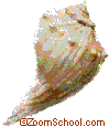
State Shell
|
Plant Symbols:
| State Flower Bluebonnet |
State Plant
|
State Tree Pecan |
State Grass Sideoats grama |
| State Shrub Chinese Crepe Myrtle |
State Fruit Red Grapefruit |
State Vegetable Sweet Onion |
State Fiber Cotton |
Earth Symbols:
| State Dinosaur | State Stone Petrified Palmwood |
State Gem Texas Blue Topaz |
Related Pages:
Texas Flag Printout/Quiz Answer questions on the flag of Texas. |
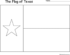 Texas's Flag: Large Coloring Printable A large black-and-white printable of the flag of Texas. |
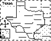 Texas: Label Me! Printout Label the major features of Texas. Answers |
Texas: Map/Quiz Printout Answer geography questions about Texas using the map on this quiz. Answers |
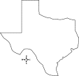 Texas: Outline Map Printout An outline map of Texas to print. |
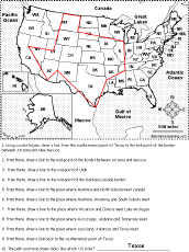
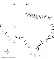 Texas: US State Dot to Dot Mystery Map Connect the dots to draw the borders of a mystery state of the USA. Then use a globe or atlas to figure out which state you have drawn. You might want to give students clues, such as that it is on the southern border of the USA, that it is where the Alamo is located, its capital is Austin or that its name starts with "T." Answer: Texas. |
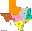 Outline Maps of Texas Regions Print black-and-white or color outline maps of 4 regions of Texas, 7 regions of Texas or more complex regional maps. |
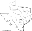 Outline Maps of Major Texas Rivers Print black-and-white outline maps of the major rivers of Texas, labeled and unlabeled. |
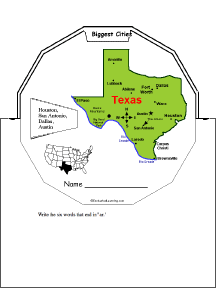 Texas Wheel This 2-page print-out makes a wheel about Texas; the student fills out the information on the wheel. It consists of a base page together with a rear wheel that spins around. After putting the wheel together, the student follows the instructions on the front wheel (coloring in the state on a US map and drawing a small map of the state) and reads information about Texas. When you spin the wheel, facts about Texas appear, including: Biggest Cities, Capital, Flag, Bodies of Water, Postal Abbreviation, State Bird, Population (rank), Area (rank), Residents Called, Bordered by, Major Industries, and Entered Union (order). |
 United States of America: Follow the Instructions #6 Draw lines on the USA map according to simple directions, such as, "... draw a line to the mid-point of Utah." Or go to the answers. Or go to a pdf of the worksheet and the answers. |
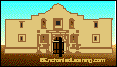 The AlamoRead about the Alamo and its history. Read about the Alamo or print a coloring page on the Alamo. |
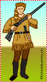 Davy Crockett Read about Davy Crockett's life, see maps of the places he lived, and do activities on this legendary frontiersman. |
 Juneteenth Theme Page Juneteenth (also called Freedom Day or Emancipation Day) celebrates the emancipation of the last remaining slaves in the USA, celebrated on June 19. Although the Civil War ended on April 9, 1865, news of the victory of the Union and the enforcement of the freeing of all slaves did not reach the outlying areas of the USA for months. Some of the last of the slaves to be freed were in Galveston, Texas; they were freed on June 19, 1865, when General Gordon Granger and 2,000 Union troops arrived. |
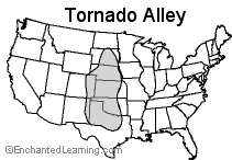 Tornado Alley Read about Tornado Alley, an area in Mid-USA that is prone to dangerous tornadoes. |
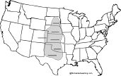 Tornado Quiz + Label Tornado Alley Printout Answer five questions about tornadoes and label the states in the heart of Tornado Alley. Or go to the answers. |
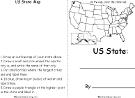
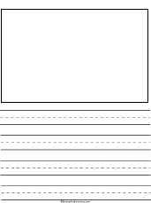 Your State: Draw and Write Draw a map of the state that you live in (in the USA) and write about it. |
 US State - Find Related Words For a US state, write eight words related to the state, then use each word in a sentence. |
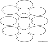
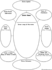 US State Graphic Organizer For one US state, write the name of the state, draw a map of the state, then write the state capital, postal abbreviation, date of statehood, state bird (draw and write), state flower (draw and write), a major body of water in the state, two bordering states, and state nickname. |
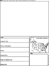 US State Report Graphic Organizer Printout #1 This printout helps the student do a short report on a US state, prompting the student to draw a map of the state, locate it on a US map, draw the state's flag, and write its capital city, state nickname, area, population, date of statehood, and state bird. |
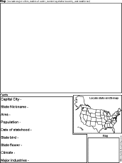 US State Report Graphic Organizer Printout #2 This printout helps the student do a short report on a US state, prompting the student to draw a map of the state, locate it on a US map, draw the state's flag, and write its capital city, state nickname, area, population, date of statehood, state bird, state flower, climate, and major industries. |
 US State Printable Book A short, printable book on a US state. To complete the book, the student must research a US state, draw its map, draw its flag, and answer simple questions about the state. |
 USA Map: Find Your State Find and label your state in the USA, and label other important geography. Answers |
USA Map: Where I Live Write your country, state, and city, and then find and label your state (and a few other geographical features). |
 Write Ten Things About Your State A one-page printable worksheet. Write ten things about your state (plus one thing you would like to change). |
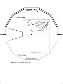 US State Wheel This 2-page print-out makes a wheel about a single US state; the student fills out the information on the wheel. It consists of a base page together with a rear wheel that spins around. After putting the wheel together, the student follows the instructions on the front wheel (coloring in the state on a US map and drawing a small map of the state) and fills out the 12 sections of the wheel with information about one state. When you spin the wheel, facts about the US State appear, including: Biggest Cities, Capital, Flag, Bodies of Water, Postal Abbreviation, State Bird, Population (rank), Area (rank), Residents Called, Bordered by, Major Industries, and Entered Union (order). |
 US State - Find a Related Word for Each Letter For a US state, see if you can think of and write down a word or phrase that is related to that state for each letter of the alphabet. Think of cities, famous people from the state, bodies of water, mountains, landmarks, and other features. Find words for as many letters as you can. |
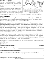
 The Census A census is an official count of the number of people in a region. The survey is done by a government, usually periodically. This page explains how and why censuses are taken. |
 Census: Printable Read-and-Answer Worksheet A printable worksheet on the census, with a short text to read, a map to color, and questions to answer. Or go to the answers. Or go to a pdf file with the worksheet and the answers. |
| US State Facts, Map and State Symbols | ||||
|
Alabama
|
Hawaii
|
Massachusetts
|
New Mexico
|
South Dakota
|
| Order and Dates of Statehood | State Population Figures | State Area Figures | State Extremes and Records |
| US Postal Codes | US Postal Codes Matching | Guidelines for Writing a Report on a State | US Geography |
Enchanted Learning®
Over 35,000 Web Pages
Sample Pages for Prospective Subscribers, or click below
|
Overview of Site What's New Enchanted Learning Home Monthly Activity Calendar Books to Print Site Index K-3 Crafts K-3 Themes Little Explorers Picture dictionary PreK/K Activities Rebus Rhymes Stories Writing Cloze Activities Essay Topics Newspaper Writing Activities Parts of Speech Fiction The Test of Time
|
Biology Animal Printouts Biology Label Printouts Biomes Birds Butterflies Dinosaurs Food Chain Human Anatomy Mammals Plants Rainforests Sharks Whales Physical Sciences: K-12 Astronomy The Earth Geology Hurricanes Landforms Oceans Tsunami Volcano |
Languages Dutch French German Italian Japanese (Romaji) Portuguese Spanish Swedish Geography/History Explorers Flags Geography Inventors US History Other Topics Art and Artists Calendars College Finder Crafts Graphic Organizers Label Me! Printouts Math Music Word Wheels |
Click to read our Privacy Policy
| Search the Enchanted Learning website for: |
Copyright ©2001-2018 EnchantedLearning.com ------ How to cite a web page